Accuracy and reliability in positioning using HEPOS: The absolute guarantee for homogeneous and economical topographic measurements throughout Greece.
General description
HEPOS (Hellenic POsitioning System) is a system that allows high-precision positioning by utilizing all existing GNSS satellite positioning systems. HEPOS is a modern positioning system similar to those operating in recent years in all the countries of the European Union.
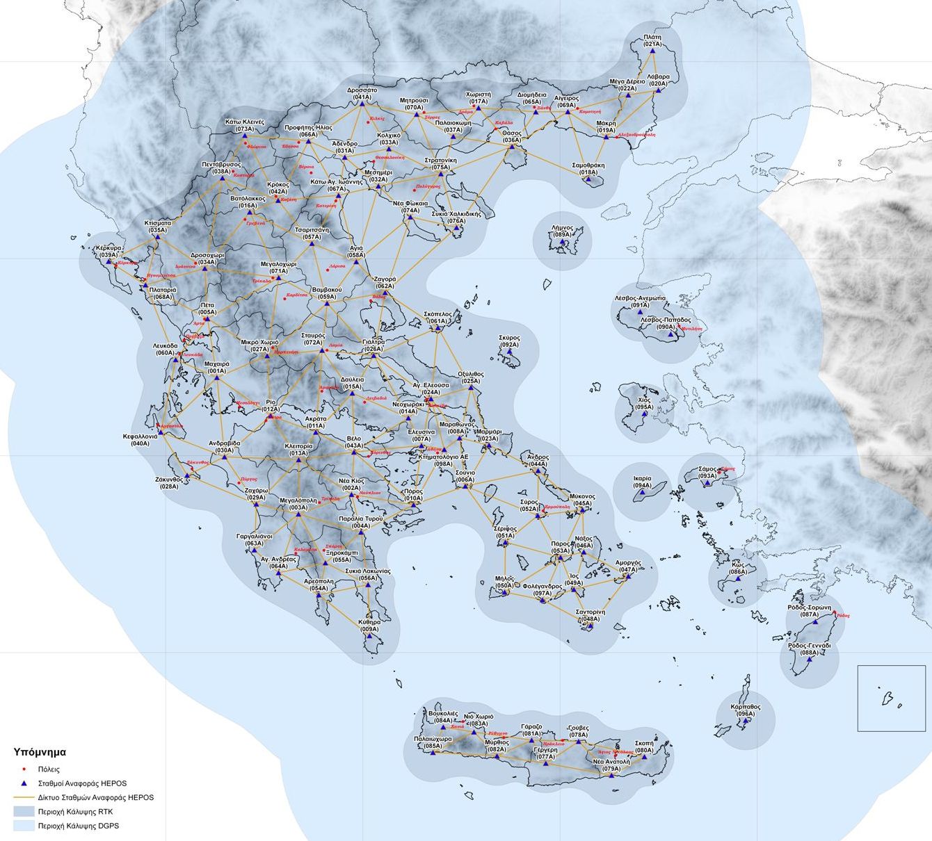
HEPOS consists of a network of 98 permanent reference satellite stations, which support a total of 4 GNSS systems (GPS, GLONASS, GALILEO, BEIDOU) as well as SBAS and QZSS and a Control Center located at the Agency’s Central facilities ” HELLENIC CADASTRE”. The reference stations are connected to the Control Center through a high-standard telecommunications network which includes, among other things, with wireless backup lines to maximize the availability of the system’s services.
HEPOS was developed by KTIMATOLOGIO S.A. (now HELLENIC CADASTRE) with the co-financing of the European Union for the aim of modernizing the geodetic infrastructure of the country and supporting the needs of the National Cadastre projects. Thus, as an infrastructure system, it is used in a number of applications in all sectors where high-precision geodetic localization is required.
HEPOS is an infrastructure project, which allows high-precision positioning by utilizing all existing satellite positioning systems (GPS, GLONASS, GALILEO, BEIDOU). Thus, homogeneous and accurate topographic measurements are achieved throughout the country, faster and more economically.
Τo whom it is addressed
HEPOS, in addition to the drafting needs of the National Cadastre, covers a number of other applications in the fields of Topography, Geodesy, Cartography and construction of technical works, etc., in which accuracy of up to a few centimeters is required. HEPOS can be utilized by a wide range of public and private users, including:
Public Agencies, Authorities and Organizations
Design and construction engineers
Project contractors under HELLENIC CADASTRE
Surveying engineers and other professional geoscientists
Universities and other research institutes